

UAV Survey & Inspection
Unmanned aerial vehicles (UAV) or ‘drones' have revolutionised the way in which surveyors work, enabling data analysis for previously inaccessible, hazardous and large-scale sites. It allows day-to-day operations to be carried out in a more cost-effective, time-efficient and safe manner in comparison to traditional surveying methods. Project times can now be counted in days rather than weeks, whilst better quality data can be gathered by smaller crews.
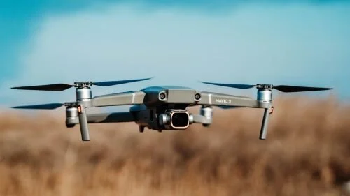
Our qualified CAA PfCO drone pilot can safely capture high-resolution imagery using our DJI drone. We can provide aerial photographic and filming surveys for your project, all shot in 4K UHD video at 60 FPS and 20MP imagery.

Benefits of Using a Drone

Quicker
Reduced survey time leads to virtually no interruptions on site, thus minimised plant downtime. Considerably more ground is covered per hour by a single drone than by a team of surveyors on foot.

Cheaper
A drone crew is cheaper than scaffolding, ropes and a ground-based surveyor with a total station, which also incurs the costs of taking equipment off-line as day-to-day business is put on hold.

More detail
Overhead imagery of a drone survey generates millions of points of resolution, whereas a conventional ground survey provides hundreds.

Safer
Minimal crew required, no scaffolding needed, rope access nor personnel working at height. Reduced site congestion leads to improved health and safety.
Our aerial services can support you in three distinct phases of a project…
Design & Planning
Whether supporting a planning application or surveying a piece of land prior to development, an aerial survey provides a new perspective on spatial layout and landscape conditions. The resulting dataset of topography and existing buildings can be easily integrated into architects’ existing workflows including Autodesk Recap.
Development & Monitoring
The ability of our equipment to map a construction site in a repeatable manner will put actionable data in the hands of key decision makers. On project completion, access to this data will facilitate in the handover from the project team to those dealing with the site’s ongoing business.
Maintenance & Inspection
Working alongside the ongoing day-to-day business of the site, including legal obligation asset inspections, insurance claims and emergency inspections. Without the need to bring in cherry pickers or set up scaffolding, there’s minimal disruption to ‘business as usual’.
Deliverables

GROUND CONTROL POINTS
Ground control points are physical markers placed on the ground which can be seen in images captured by the drone. The position of each of these ‘targets’ is marked with actual GPS coordinates.

POINT CLOUD DATA
Point clouds consist of millions of points in 3D space to show the external shape of an object.

3D MODELS
Point cloud with a textured mesh laid on top to give an accurate, photorealistic appearance of the building.

HI-RES PHOTOS
High resolution still images, up to 20 megapixels. They can be used for both inspection and promotional purposes.

VIDEO
Digital video, up to 4k resolution, can be the best way to inspect certain elevated or unreachable points of interest.

PHOTO MAPPING
An orthomosaic is a highly detailed, date specific satellite view. By stitching thousands of images, the map gives a ‘real time’ overview of the whole site, and the ability to zoom in to details to a resolution up to 10mm.

TOPO MAPPING
Topographical map using a colour scale to represent elevation change over an area of land. This method of mapping is ideal for use in construction site planning and earthworks.

ANALYSIS TOOLS
A selection of tools to annotate, measure or make volumetric calculations to quantify the metrics of land or mass, e.g. the length of a wall, area of construction site or the volume of a stockpile of gravel.
How It Works


step 2 ▸ Estimate
Receive our quote with a simple tick list where prices and services are 100% clear.

step 3 ▸ Completion
We keep you updated throughout the job process and share the completed survey for your approval.
Contact us
get a free quote ▸

Get to know us…
